Wednesday, July 6, 2016

Gear Review: Altra Superior 2.0

Altra Superior 2.0 trail shoe
Altra Superior 2.0


Introduction
Although Altra is a newcomer to the running industry, it has quickly gained a strong fanbase in the ultra trail running community. Altar's unique selling points: zero drop, a foot-shaped toe box and A-bound midsole material, have enabled it to be at the forefront of shoe design. It also caters to semi-minimalist needs as well as to those who prefer a more maximalist shoe (e.g. their Olympus model)

I have been training and racing in my faithful pair of New Balance Leadville V2s for some time now and was looking for a replacement pair. Altra's design philosophy caught my attention, and since i have wide feet , i decide to go ahead give the Superior 2.0 a try. Once again, there are many great reviews on the web but this is my own take on it. I also hope to give views from a Singaporean perspective.

I have had this pair for 2 weeks and have logged in around 35 km in them on both trails (MacRitchie and Mandai Track 15) as well as speed work in East Coast Park. This review will be based on my initial usage of these shoes. Will do a longer-term review later on. 

Overview
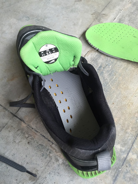
Just holding these in your hands, you can tell these are a light  pair of shoes. It comes with a pair of removable  Altra Stoneguard rock plates. This is a great idea if you feel that you do not need that much protection on certain trails and want to shed some weight.

Upper
i love the upper so far. It is light, firm and very airy. You can actually see through it. Singaporean runners will know that all it takes is an hour run in our humidity to totally drench your shoes with perspiration. We are all familiar with the "squish squish" feeling. These shoes do soak up sweat but dries up pretty fast. It also drains out well after running through puddles. The laces are light and stay tied during my runs. The gusseted tongue is nice and thin, with just enough padding. Toes are sufficiently protected from rocks by the toe bumper and extra lamination on the front end of the shoes.

Altra Superior 2.0 trail shoe
The Superior 2.0 is a great looking pair of shoes!

Interior
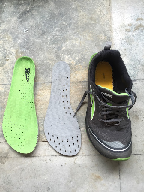
The removable Stoneguard is a great idea and it works as it should. I have not tried running without it. The foot shaped toe box really does allow your toes to spread out naturally and adds to stability. I do find that the overall volume of the toe box is still very small, the top of the toe box seems to press down on the tops of toes. I hope this will not be an issue on my 50km race next Saturday. I wear Injinji toe socks, so that could explain the tighter feeling I get from the toe box.

Altra Superior 2.0 trail shoe
The grey removable Stoneguard goes in under the green insole

Altra Superior 2.0 trail shoe
The Stoneguard fits very snuggly inside the shoe. It stays in place throughout the run.


Midsole
The midsole is responsive and offers a good balance between cushion and trail feel. Coupled with how naturally your toes can spread out, you feel more stable on uneven terrain (read: the stretch of trail between MacRitchie Ranger Station and Jelutong Tower). The zero drop profile does feel more natural when you are running, especially switching over from the 8mm dropped Leadville V2.


Outsole
Mega grip on dry and muddy trails. I have yet to test it on wet rocks, in the rain. I think that will be the ultimate test to see if a trail shoe can hold its own in Singapore. The outsole tread pattern plus the toe splay really makes you feel like you are able to dig deep and claw your way up anything. The lugs are deep yet clean themselves very well. The deep lugs did not seem cumbersome too when I did a 11km fartlek on tarmac. 


Altra Superior 2.0 trail shoe
Super grippy and sheds mud well.

Sizing
The Superior 2.0 is notoriously short in length, so it is highly recommended to at least size up half a size. Some wearers need to up a full size. Best to try these on in person, and in Singapore you can do it at Fast Corner on the second floor of Queensway Shopping Centre. They are the official local distributor of Altra products. 


Summary
This is trail shoes that is light, responsive and makes you feel fast. Most reviewers reckon the Superior 2.0 can handle distances up to 50miles. Due to the lower stack height and relatively lack of medial support, I think this is a fair view. I will be personally putting this to the test next Saturday at the MSIA Action Asia Singapore 50km trail ultra. Get this pair if you want a fast and light trail shoe that has zero drop and a wide toe box. 

Altra Superior 2.0 trail shoe
Will be putting these through the grinder, stay tuned for a longer-term review!

Sunday, July 3, 2016

Gear Review: Ultimate Direction Scott Jurek (SJ) Vest 2.0


Ultimate Direction Scott Jurek (SJ) Vest 2.0. Singapore
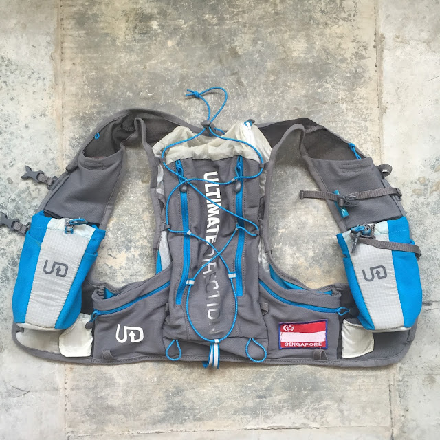
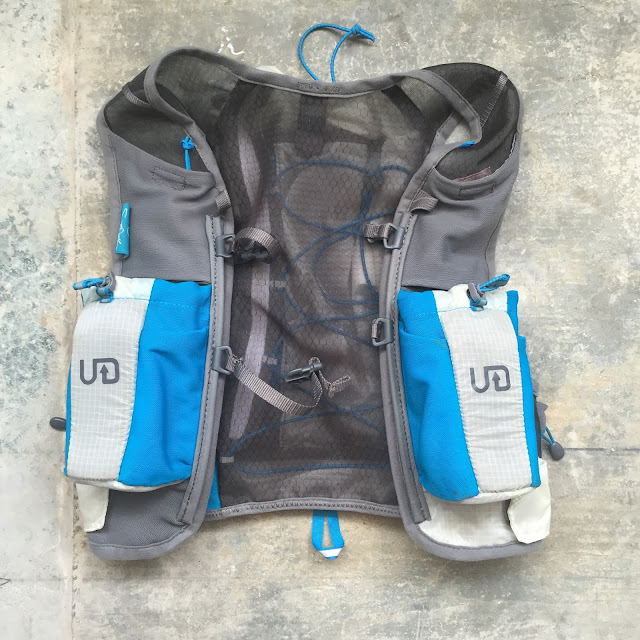
Rear of the vest. Small zippered pockets along the bottom "wings" of the vest offer spacious and secure but slightly inaccessible storage.


Ultimate Direction Scott Jurek (SJ) Vest 2.0. Singapore
The front shoulder straps offer ample storage. the top two grey mesh pockets need to slightly bigger to accommodate the size of newer smartphones. This has been addressed in version 3.0
Ultimate Direction Scott Jurek (SJ) Vest 2.0. Singapore
UD SJ Vest 2.0 fully loaded during the Borneo Ultra Trail Marathon 2016


 There is already so much written about this amazing vest that I won't say more apart from the fact that it really is a very reliable vest to use in training and during races. Capacity is sufficient to hold compulsory race items such as a waterproof jacket, 3 Clif bars, 4 Clif shots, 1 Clif protein bar, a packet of Nuun electrolyte tablets, an iPhone in waterproof case, 3 x Hydrapack 500ml Softflasks, a battery pack, headlamp, reflective vest and basic first aid kit.

Once fitted on properly, there is simply no bounce and follows your body's movement while running. The only niggle i have is that the two small zippered pockets at the bottom of the rear of the pack are quite hard to access while wearing the pack. I have occasionally strained my shoulder while trying to get stuff out of them. I believe the latest version 3.0 has addressed this issue.


If you are the sort that isn't that fussy on having the latest gear or if you are a runner on a budget, look out for the many clearance sales as Ultimate Direction is clearing the way for the latest version 3.0. This vest will offer you a simple and reliable solution to carrying hydration and gear on your next trail adventure.


Race Report: Borneo Ultra Trail Marathon 2016


Trail running has been in my blood since I was a school boy running cross-country for my secondary school. The Victoria School boys cross-country team was and still is famous for consistently being one of the top teams. I had the privilege of running for and being part of the team that won the national school championships 3 years in a row. A big shout out has to go to our coach Mr Ho Kiat Chong, who is the one who gave me the love for the sport. He taught us discipline and endurance through distance running, and I treasure these precious lessons till today. Thank you Mr Ho!


Fast forward 20 years: I am still loving the sport, but this time cranking up the distance. I have completed two full road marathons and two trail 50km races, but I was searching for something more challenging. My ultimate goal is to race the Ultra Trail du Mont Blanc (UTMB) but at 100 miles, over very challenging and vertical terrain, it is still some way more till i can get there. So the plan is to get more race experience over longer distances and also more varied terrain.

As part of this journey, I entered the Borneo Ultra Trail Marathon (BUTM) two weeks after completing 52.5km at the MR25 Trail Ultramarathon in December last year. I guess you could say I signed up on a runner's high!

After the MR25 race, I allowed some time for rest and recovery before resuming training in February 2016. My mileage was not as high as I would have liked due to work commitments but I did the best I could. The key was to always head out enjoying my runs , which is vital to running such long distances. Another crucial thing that helped me during the race was doing the back-to-back long runs on the weekend. So I would typically head out for a 3 hour run on Saturday and then do a 2hr+ run on Sunday. This served to let my body and mind get accustomed to working when I was tired. As traditional ultra training wisdom says, it is the time on your feet that matters. I also worked on the stairs (30 storeys x 5 times) just to get used to the amount of climbing we would be doing in the BUTM.  I would have liked to have done longer runs and more vert training, but work, travel and illness took away the better part of the training period. I also was very disciplined about foam rolling and stretching, which helped me stay injury free throughout.


Borneo Ultra Trail Marathon 2016. BUTM 2016
BUTM 2016 Start area, Tamparuli Valley (Kota Kinabalu)

The Borneo Ultra Trail Marathon 2016 was held on 4 June and had categories for 12km, 25km, 50km and 100km. I signed up for the 50km. The weather was really nice and cool at the start but we all expected hot sun later in the afternoon and also heavy rain even later on in the day.


Borneo Ultra Trail Marathon 2016. BUTM 2016
Keeping warm at the start


Borneo Ultra Trail Marathon 2016. BUTM 2016
The main tent where all race organization takes place. I am amazed at the grassroots nature of this race and throughly enjoy this simple yet well-organised event. Kudos to the organising team!


Borneo Ultra Trail Marathon 2016. BUTM 2016
50km Course Profile (this is not the latest map we used, i couldn't seem to find it but the only difference was the naming of the water stations after WS 2)

The 50km course would prove to be a fun but tough one, and by the end of it runners would have climbed a total of more than 2000m. For a Singaporean with no mountains to train on, this is by no means an easy task.

The race started well but things started to go wrong after our group of around 12-15 runners missed a route marker and went the wrong way after leaving WS1. We ended up having to bash through the jungle, desperately trying to head straight towards the nearest 4x4 vehicle main track. By using my compass and map, and also the altimeter readings from another runner's Suunto, we eventually reaching the main 4x4 dirt road in between WS2 and WS3.

Borneo Ultra Trail Marathon 2016. BUTM 2016
Strong pace coming out of WS1


Borneo Ultra Trail Marathon 2016. BUTM 2016
Jungle bashing along rubber tapper tracks


Borneo Ultra Trail Marathon 2016. BUTM 2016
Crossing streams with refreshing water helped us keep our sanity in our push to get out of the jungle


We were so thrilled to meet a lady tapping rubber in her plantation, and she told us which direction to head towards WS2. By this time we were more than an hour delayed and around 4km off course. We had to make the mind numbing run backwards to WS2 in order to check in there, otherwise we would be disqualified. We all eventually made it back to WS2 after 30mins of hard running along a mainly upslope journey. After quickly filling up our now depleted water supplies (it is compulsory for all runners to be able to carry a minimum of  1.5litres of water) I was finally back in the race proper.


The rest of race was spent digging deep and reminding myself that I have trained hard for this and this sure beat being cooped up at work back home! I found the steep downslopes tough on my quads and this is something that I need to work on in future training. There was a point when I was actually scared of losing control of my legs when negotiating a steep, muddy slope in the middle of a huge downpour. The slope had literally turned to flowing sheets of mud and gravel, and sustaining grip on such a surface was a painful affair.

Borneo Ultra Trail Marathon 2016. BUTM 2016
Me managing a smile after the toughest climb of the race: 50 degrees straight up a forested slope to reach this clearing.


Borneo Ultra Trail Marathon 2016. BUTM 2016
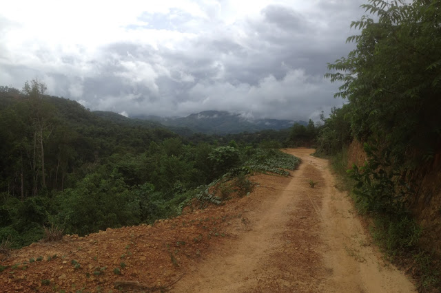
Typical trail during the race.


One of the highlights of the race was the many suspension bridges we had to cross. For me these provided a much needed break from the monotony of the trail and also a chance to catch my breath as we had to walk across it instead of running for stability issues. The scenery was also captivating and never failed to lift my spirits and remind me why I enjoy being outdoors.

Borneo Ultra Trail Marathon 2016. BUTM 2016
Typical suspension bridge 


The final 20km were the hardest but fastest kms during my race, partly due to the relatively smaller climbs but also because i was running with a fellow racer who i made friends with. we both were in the group that got lost and we kept each other going for most of the race. We cracked jokes about how we were wearing the same grey Uniqlo running top , and i started calling him Uniqlo. Found out his name, and now Ahmad and I follow each other on Strava!


Borneo Ultra Trail Marathon 2016. BUTM 2016
Typical climbs during the race.
As with any race, the final 8kms seemed like an eternity and running through cold rain with heavy shoes made it feel more arduous. I could hear the commotion of the finish area over the river but it was a long way more till the final road that crossed to the other side. By this time, i was on my own having left Ahmad further behind. He had urged me to go on and so i went ahead, determined to go under my 10hr goal. I finished the race in 9 hrs 28mins , with Ahmad coming in just under 10mins later.   I finished 19th overall, and 2nd Singaporean. The first was a Singapore lady who totally whopped my a$$ in the final 3kms.


Borneo Ultra Trail Marathon 2016. BUTM 2016
Done! pardon the blurry photo taken by iPhone 4.


What an amazing race and even more amazing opportunity to have experienced Borneo this way. This race has taught me not to give up and I was happy that i remained in control all the time, even after having had to run extra distance due to getting lost. Here's to more ultras in the future !


[Check out the race stats and follow me on my Strava account]


Monday, June 20, 2016

Trip Report: Yosemite National Park (September 2015)

It has been way too long since my last post (3 year hiatus), my apologies!

Since my last adventure in Xueshan (Snow Mountain), I have been on a few more memorable trips and the most significant was a trip with my wife to Yosemite National Park. A huge tick off my bucket list! This was part of our big annual trip to USA in September 2015. Details are a bit sketchy in my mind now, but here is a quick and dirty report of a place I will never forget. Forgive me too for the grainy photos, due to an iOS update incident, I lost all my US trip photos. The photos here are cropped from my Instagram page. Follow me at @joeyganners.


_________________________________________________________________________________


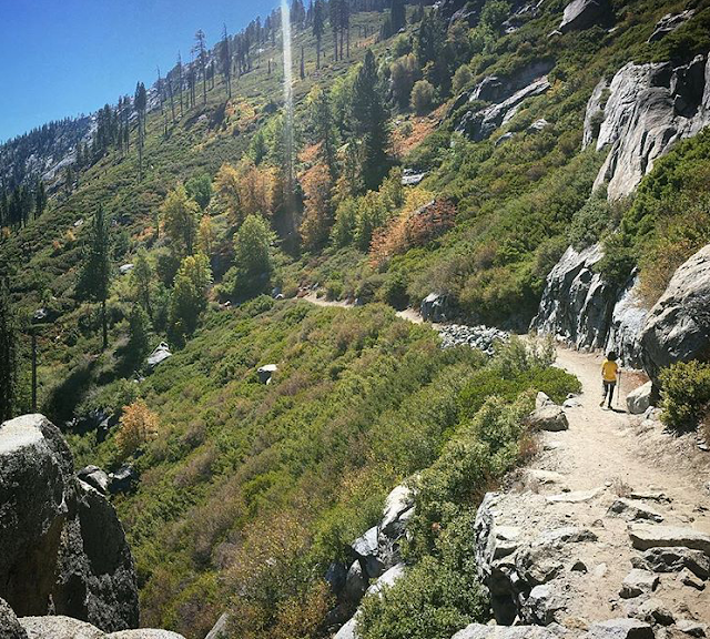
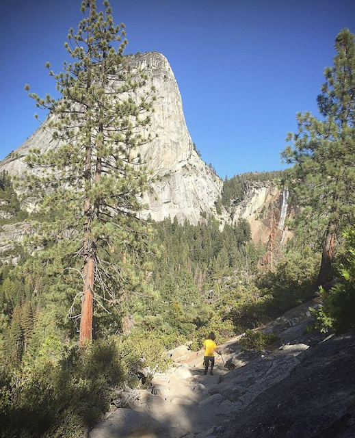
Yosemite Valley,  September 2015. View from Panorama Trail
Yosemite Valley,  September 2015. View from Panorama Trail


"The mountains are calling and I must go.." 
- John Muir , 3 September 1873


Even as a true blooded, flat-landed, urban Singaporean, my heart truly sings the famous words written by American naturalist John Muir in a letter to his sister. There is something magnetic, magical about being in the mountains, and I answered Yosemite's siren call.


Our visit to Yosemite National Park was made on route from Portland, OR (where we did heaps of cycling, we brought our road bicycles with us!). On our drive, we made a stop to view the Redwoods trees, which is another tick on my bucket list. The mind boggles at how a tree can be so big. Amazing indeed is God's wonderful creation.


Driving down the I-5.
Driving down the I-5. We did not have enough time to take the more scenic 101 highway. Still, pretty stunning scenery. You would never get such a completely flat horizon like this in Singapore!


Large redwood at Jedediah Smith Campground (Jedediah Smith Redwoods State Park)
Treehugger
Large redwood at Jedediah Smith Campground (Jedediah Smith Redwoods State Park)

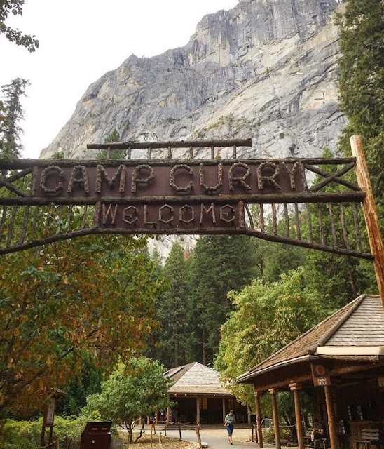
We reached Yosemite National Park's Camp Curry (in Curry Village) quite late at night and we were thankful for a comfy cabin to rest in. Camp Curry is very well set up for the needs of visitors. We would have preferred a more adventurous experience of camping in the outdoors but we were too late in booking camping permits. September is usually the height of hiking season so bookings have to be made almost a year in advance. We also wanted to summit Half Dome, but the same reason prevented us from doing so. Need better planning next time. But not being able to summit Half Dome was a blessing in disguise and we used the time to explore more of Yosemite Valley via the a combination of the Four Mile Trail and Panorama Trail (total journey of 21.1km)

Camp Curry. Yosemite National Park
Certainly no curry available here


Four Mile trail. Sentinel Rock
Four Mile Trail offers classic mountain switchback routes and amazing views of Sentinel Rock through the hike up towards the end point at Glacier Point. From Glacier Point, we chose to continue from the trail head of Panorama Trail all the way back down to the Valley.


Black bear cub. Yosemite National Park. Four mile trail
We saw our very first Black Bear cub. This young one caused much concern among us and fellow hikers: everyone was worried about where is Mommy Bear??!!


Yosemite Valley. Merced River. Sentinel Rock. Yosemite Falls
Yosemite Valley and the Merced River from Four Mile Trail. This iconic view of the valley is framed by Sentinel Rock on the left and Yosemite Falls on the left. It was a dry summer so the falls are not visible.


Stunning drop-offs next to the Four Mile Trail


Panorama Trai. Yosemite Valley. Glacier Point
Panorama Trail. The trail head starts from Glacier Point. This trails offered us much peace and solace from the crowds that came up to Glacier Point by bus.


Panorama Trail. Half Dome
The lower half of Panorama were characterised by large size rocks and boulders. Trekking poles offered must needed support going down. We also had great views of Half Dome.


Our entire hike started at around 8am and we ended the day just before 6pm. It was a challenging but simply awesome hike, a definite must-do if you are visiting Yosemite. It is advisable to have reasonable fitness. Pack sufficient water (at least 1.5 litres per person in summer is good), you can refill your water supply at the water fountains at Glacier Point. Trekking poles are highly recommended and a grippy pair of trail shoes / boots with ankle support is a must. Don't wear new footwear on this hike, it is not a trail to test your new pair of shoes on! We sustained our energy through trail mix and energy bars. 


Last tip, don't start your hike without a cup of Yosemite coffee! :) It is a great way to start any hike!


Tuesday, August 6, 2013

La Sportiva Pamir

La Sportiva Pamir Gore-tex
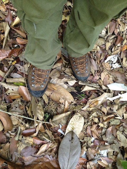
La Sportiva Pamir, post Xueshan.


"Take care of your feet, and your feet will take care of you!"

These words were drummed into my head during national service and my instructors did such a good job that it has never left my being till this day.  This heavy duty, well constructed and super-stable offering from revered mountain sports giant, La Sportiva, definitely took care of mine during my Xue Shan trek. A high quality leather and Gore-tex lined upper, paired with a reliable Vibram sole, made light work of Xue Shan's upper trails which consisted of scree the size of televisions and small cars. The lacing system is also amazing: the fourth highest eyelet will automatically cinch down as you pull the laces up, allowing you to finish off tying your laces without having to maintain tension at the same time.


Vibram Sasslong Hiking Boots
Vibram Sasslong outsole.

The Vibram Sasslong rubber outsole proved to really grippy on the trail and the padded, high-cut upper saved my ankles when I slipped on a patch of icy grass. These boots are indeed on the heavy side and work well when you are carrying a heavy pack. I tried using these boots for work in the forest, but they are a bit hot and heavy for Singapore's weather. Still, the support and traction they provide is currently the best I have experienced in any boot so far. These are pricey boots, as expected from the heritage and quality that La Sportiva is known for. I bought these from Campers Corner  and managed to get a discount through a friend. Overall, these are great boots and are built for heavy duty backpacking and technical trails. 


La Sportiva Pamir Gore-tex lining, Bukit Timah Nature Reserve
On home soil in Bukit Timah Nature Reserve


Saturday, March 23, 2013

Trip Report: Xueshan (Snow Mountain), Taiwan


Xueshan (Snow Mountain), Taiwan


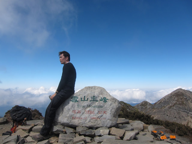
At 3886m, Xueshan or Snow Mountain is the second highest peak in Taiwan and the highest mountain I have ever summited. And what a glorious adventure it was! It was 3 days and 2 nights of nothing but breathtaking scenery and great company. Here's a summary of how it all went.


Day 1


It is about a 4 hour drive from Taiwan's Taoyuan International Airport to Shei-Pa National Park and then into Wuling Farm which is a recreational area within the national park. It is still winter in February and we arrived at the peak of the cherry blossom season. Thankfully we arrived early enough to avoid the crowds but there were already hardcore photographers in position when we drove in around 630am.


Xueshan (Snow Mountain), Taiwan
Add caption

Xueshan (Snow Mountain), Taiwan


After watching an introductory video of Xueshan played for us by the park rangers, we headed off from the trailhead. Xueshan here we come!

Prior to the trip we were told to prepare for frozen rivers and water sources so we packed about 6 litres of water each and winter-specific equipment such as crampons and ice axes. We were rather disappointed to find out that latest reports from the summit revealed that was no snow at all even past the tree-line. Looks like we weren't going to see Xueshan covered in xue (snow).

The hike started out pretty comfortable for the weight I was carrying, the most i have ever carried on a hike due to the water requirements. But this was just the beginning of course. The first couple of kilometres up to Cika Hut was a series of stepped switchbacks on nicely packed, dry trail.


Xueshan (Snow Mountain), Taiwan


Xueshan (Snow Mountain), Taiwan


Xueshan (Snow Mountain), Taiwan

We rested for a couple of minutes at Cika Hut and then resumed. The plan was to reach the summit by 2pm and then trek down to Cuici Pond for a night a the Hut there. 

The hike was beginning to take its toll on D and me. J, even with his prior experience on this trail was suffering too from lack of sleep due to his shift work the day before. By the time we reached East Peak at 3201m around 12noon, we were far off the pace to make it to the summit AND back down to Cuici Hut for the night. 

Xueshan (Snow Mountain), Taiwan
Heading to East Peak


Xueshan (Snow Mountain), Taiwan


Once we reached East Peak, the decision was made to head straight to 369 Hut and spend the night there instead of heading to the summit. We would then rest and make a summit bid the next morning. The trek to 369 Hut was by no means easier and I was stoked to finally see the hut through the trees.


369 Hut


369 Hut is a simple elongated single storey cabin with enough room for 106 hikers. Inside are two rows of wooden double deck bunks, on which are lined with thin black rubber mats. These act as rudimentary sleeping surfaces but one must come with your one sleeping pad and bag as the nights at 369 Hut get cold (-1 degrees celsius) in the winter.
I do not have any photos of the interior as by this time i was tired out and plagued with a throbbing headache (mountain sickness ?).

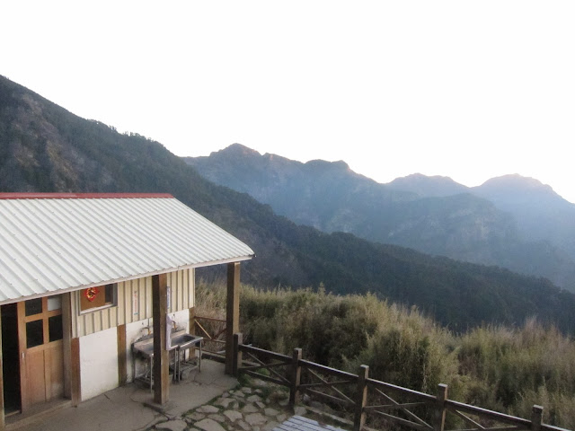
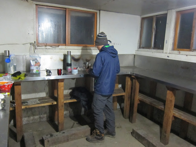
A level below the sleeping quarters is a small hut in which you prepare and eat your meals. It is a really simple yet effective little space that provides you a place to cook out of the wind and cold.


Xueshan (Snow Mountain), Taiwan
The kitchen with a lovely view


Xueshan (Snow Mountain), Taiwan
Dinner time!


Dinner was a simple affair of dehydrated food reheated with boiling water and some fresh mushrooms and cabbage we bought from 7-11 (yes that's right, Taiwan's 7-11 stores are amazing, a whole separate story for another time!). I headed to bed pretty soon after dinner as my headache was killing me, even after taking two aspirins.


Day 2


Our second day started at 430am, same as the rest of the other hikers in 369 Hut. Breakfast was cooked and consumed, bags pack and we got ready to set off as soon as there was enough light to see the trail. I was looking forward to today's trek as I heard that the scenery would be better. It was unfortunate that there wasn't going to be snow as this winter is unusually warm and dry.


Xueshan (Snow Mountain), Taiwan


Xueshan (Snow Mountain), Taiwan


The forest above 369 Hut consists of mainly Abies kawakamii (Taiwan fir). It is said that it used to cover a larger swath of land but a fire broke out some time ago and burned through a great part of it, leaving behind charred white trunks as memory to what was once a thriving forest.


Above this , we entered the much spoken about Black Forest. CW told us that in a proper winter situation, the area would be blanketed in snow, making the forest seem like a scene out of a Lord of the Rings movie.


Xueshan (Snow Mountain), Taiwan


We soon broke beyond the tree line and there loomed in front of us the objective of our quest:


Xueshan (Snow Mountain), Taiwan

The cirque behind me leads up to the peak of Xueshan and is normally entirely covered in snow in winter, but here you can see how dry and warm this winter has been!


Xueshan (Snow Mountain), Taiwan

900m more to go!!


Xueshan (Snow Mountain), Taiwan


 There was still a fair bit of ice on the trail and we had to pick our way carefully to avoid slipping. I figured that since i had already spent money on an ice axe and crampons, i decided to try them out. It was fun to be able to stab the crampons and axe into the ice, but eventually the trail start to become more rocky than icy, so we ended up not using them for the rest of the trek up.


Xueshan (Snow Mountain), Taiwan
D powering up the mountain

Xueshan (Snow Mountain), Taiwan
too cool for skool


Xueshan (Snow Mountain), Taiwan
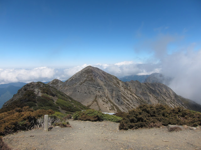
View of The North Corner from the summit


We reached the summit around noon and we decided to climb up to the North Corner of Xueshan. This involved trekking down and then climbing up literally on all fours to reach the top. It was a gnarly experience and I am glad we didnt have snow to contend with. 


After enjoying the awesome views, we head down and up to the summit to get out packs and then we made the descent down to Cuici Pond


Xueshan (Snow Mountain), Taiwan


I will never forget the boulder strewn slopes that bridged the top of Xueshan to the lower valleys of Cuici Pond. In the picture about you can see where the trail starts at the top (the U shaped part of the ridge). The boulders were mostly the size of huge watermelons, with many more the size of couches.


Xueshan (Snow Mountain), Taiwan
Cuici Pond (Cuici Hut can be seen behind the trees in the centre of the photo)

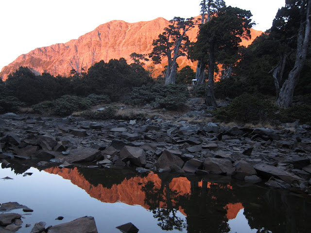
We reached Cuici Pond around 5pm and we went to check out the pond. We were very low on water and we brought our bottles to collect water. Again, due to the warm and dry weather, the pond has shrunk to about 1/3 its size. Water collection had to done carefully so as not to stir up the silt. We would later clean the water by sterilising with puri-tabs and boiling it. Despite the lost in pond size, it still allowed for pretty spectacular reflections of the ridge behind the hut. The setting sun caused the ridge to change hues as the sun got lower and lower on the horizon.

That night in Cuici Hut was the coldest I have ever spent, around -5 deg. celcius. Not funny at all but i would not trade that experience for anything else. Now I know what cold is! It was partly my fault too as I tried to cut pack weight by bringing a three season sleeping bag paired with a liner. The liner I used was a Sea to Summit Reactor and it did as good a job as it could possibly do, without it I probably would have suffered even more.


Day 3


We started out at 630am the next day and we took the exact same route back. Apart from having to climb back up the boulder field to the summit, the rest of the trip back was mostly downhill and we really motored on. We wanted to get back in Taipei in time to return the rental car and we knew we had to contend with the weekend crowds coming into Wuling to view the cherry blossoms. With this spurring us on, we reached the trailhead by 230pm, which was super fast. 


Summary

I thoroughly enjoyed the trip and my advice to anyone attempting this in winter would be to train up with the appropriate load (approx 20-25kg) as you will be carrying a lot of water due to frozen water pipes and streams, in addition to winter/ice gear. Even in a warm and dry winter like this, the extra water we carried was vital to a safe trip.  I will be posting reviews of the gear used during the trip soon. Stay tuned!